Enhanced Understanding
OrbitLync revolutionizes the way sectors access and interpret geospatial data. At the heart of the solution is the capability to harness satellite-derived information, processed in real-time, directly at the edge. This approach not only ensures minimal latency but also maximizes the precision of the data available for analysis. The OrbitLync technology sifts through the noise to bring forward clear, actionable insights, laying the groundwork for informed decision-making processes.
Smart Decisions
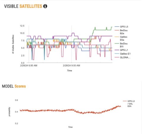
In a world inundated with data, the power to decide with confidence rests on the quality of insights derived from that data. OrbitLync’s edge AI algorithms play a pivotal role here, transforming complex geospatial datasets into comprehensible, decision-ready information. The system evaluates patterns, detects anomalies, and predicts trends, offering users a solid foundation for making critical decisions. OrbitLync ensures that every decision is backed by reliable, real-time intelligence.
Strategic Actions
OrbitLync is designed to translate insights into efficient, effective actions. It not only identifies the best courses of action but also facilitates the seamless execution of these strategies.
For mariners, it signifies enhanced navigational safety through immediate response to emerging threats or changes in the maritime environment. For the military sector, this could mean the deployment of resources to areas of strategic importance.
Across multiple sectors, OrbitLync empowers users to act with a level of precision and efficiency that sets new standards for operational excellence.
Key Features
Empowering maritime, military, and civilian sectors with real-time, eco-friendly geospatial analytics.
Navigational Safety and Security
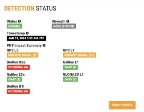
Enhanced situational awareness through geospatial data analysis to detect anomalies and threats.
Reduced Carbon Footprint
Sustainable alternative to traditional cloud-based AI solutions, significantly lowering your organization’s environmental impact.
Operational Efficiency
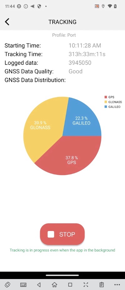
Low-latency processing optimizes navigational decisions for speed, safety, and fuel efficiency with up-to-date data.
Scalability and Flexibility
Lightweight framework can be adapted for a wide range of applications, from IoT devices to mobile applications, ensuring you stay ahead of the curve